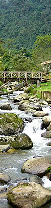
Colombian Geography Facts. Hydrography: Rivers, Lakes, Dams, Reservoirs, Amazon River


COLOMBIAN GEOGRAPHY - II
Español
Français


1


HYDROGRAPHY

Colombia is one of the richest countries in water resources.

Its rivers drain into four areas: the Caribbean Sea, the Pacific Ocean, the Orinoco River Basin and the Amazon River Basin.

The Caribbean: The Magdalena River, along with the Cauca River, its main tributary, the Atrato River, the Sinú and Catatumbo rivers, as well as the rivers and their tributaries that flow down from the Sierra Nevada de Santa Marta, form a drainage basin that feeds into the Caribbean Sea.
This drainage basin is the most important one from an economic point of view.

The Pacific: The drainage basin that feeds into the Pacific, consists of more than 200 rivers. The most important are the Baudó, the San Juan, the Patia and the Mira Rivers.

The Orinoco drainage basin. For 250 km, the Orinoco River serves as a boundary between Colombia and Venezuela. Its drainage basin comprises the Arauca River, Meta, Vichada and Guaviare Rivers.

The Amazon drainage basin. The Amazon River is considered to be the second most important river in the world. Within its drainage basin are the Guainía, the Caquetá, the Vaupés and the Putumayo Rivers.

The Colombian Massif or Nudo de Almaguer is called the "Star of Rivers" because four very important rivers originate in this massif: The Magdalena River, the Cauca, the Caquetá and the Patía Rivers.


MAJOR RIVERS OF COLOMBIA

There are many important rivers in Colombia. The major ones are: the Magdalena River, Cauca River, Caquetá, Putumayo, Guaviare, Meta and the Atrato Rivers.
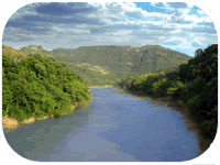
THE MAGDALENA RIVER is the most important commercial waterway in Colombia, as well as a source of electric power and natural beauty. It originates in the southern region of the country, near the Magdalena Lake in Páramo de las Papas of the Colombian Massif. The Magdalena River flows northwards through Colombian territory to the Caribbean Sea in Bocas de Ceniza. Its total length is 1,558 km, navigable without interruption for about 1,300 km. It is the longest Inter-Andean River in South America. Its basin has an area of 256,622 square kilometres. It has about 500 tributary rivers and more than 5,000 streams drain into it.

THE CAUCA RIVER starts in the Colombian Massif near Laguna del Buey, flowing northwards between the Western and Central cordilleras to its mouth at the Magdalena River in Bolívar department. With a length of 1,350 km and a navigable area of around 620 km, the Cauca River is the second longest in the country.

THE CAQUETÁ RIVER
flows eastwards through Southern Colombia for about 2,200 km from its source in Páramo de las Papas in the Colombian Massif, to its junction with the Amazon River.

THE PUTUMAYO RIVER begins its course in Nudo de los Pastos and flows 1,800 km eastwards, serving as a border between Colombia and Peru and between Colombia and Ecuador. It is a major transportation artery, navigable for almost its total length. The Putumayo is a main tributary of the Amazon River.

THE GUAVIARE RIVER, with a length of approximately 1,350 km, is formed at the junction of the Ariari and Guayabero Rivers in the Cordillera Oriental in the western part of Meta department.
It meanders east-northeastward between Vichada and Guainia departments until it joins the Orinoco River.

THE META RIVER is the main river of the Colombian Eastern Plains (Llanos Orientales), with a total length of 1,200 km. It is formed in Meta department by the junction of the Humea, Guayuriba and Guatiquia Rivers. It flows east-northeastward across the Eastern Plains to its mouth at the Orinoco River.

THE ATRATO RIVER is 700 km long and holds the highest volume of water of any river in Colombia. It originates in the Cordillera Occidental and flows into the Gulf of Urabá in the Caribbean Sea.
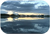
CIÉNAGAS = SWAMPS
There are about 1,900 swamps that cover more than 7,800 square kilometres of the Colombian territory.

REPRESA = DAM  -    = EMBALSE = RESERVOIR
LAGO = LAKE  - LAGUNA = MINOR LAKE


Mayor Swamps Dam, Lakes, Minor Lake Reservoirs
Ciénaga Grande de Santa Marta - Magdalena
Ciénaga Chilloa - Magdalena
Ciénaga Pijiño - Magdalena
Ciénaga Malibú - Magdalena
Ciénaga Plato o de Zárate - Magdalena
Ciénaga Sapayán - Magdalena
Ciénaga San Antonio - Magdalena
Ciénaga Buenavista - Magdalena
Ciénaga Pajaral - Magdalena
Ciénaga de Zapatosa - Magdalena y Cesar

Ciénaga Doña María - Cesar
Ciénaga Sahaya - Cesar

Ciénaga Tumaradó - Antioquia
Ciénaga Marimonda - Antioquia
Ciénaga Palo de Agua - Antioquia

Ciénaga Grande del Sinú - Córdoba
Ciénaga de Ayapel - Córdoba
Ciénaga Betanci - Córdoba

Ciénaga de Machado - Sucre
Ciénaga Catalina - Sucre
Ciénaga La Cruz - Sucre
Ciénaga Santa Lucia - Sucre
Ciénaga Las Garzas - Sucre
Ciénaga Mojanita - Sucre

Ciénaga Quintañilla - Bolivar
Ciénaga Job- Bolivar
Ciénaga Morrocoyal - Bolivar

Ciénaga Colorada - Santander
Ciénaga Paredes - Santander
Ciénaga Opón - Santander

Ciénaga Totumo - Atlántico
Ciénaga Laruaco - Atlántico

Ciénaga Palagua - Boyacá
DAMS
Represa del Guavio (la más grande
del país) - Cundinmarca
Represa de la  Regadera
- Cundinmarca

Represa de Río Grande - Antioquia
Represa Miraflores - Antioquia
Represa Troneras - Antioquia
Represa El Peñol - Antioquia
Represa de Guadalupe - Antioquia

Represa de Calima-Valle del Cauca
Represa de de Anchicayá
Valle del Cauca

Represa de Urrá - Córdoba
Represa La Salvajina - Cauca
Represa de Chivor - Boyacá
Represa del río Prado - Tolima

LAKES

Lago Chingaza - Cundinamarca
Lago Cucunuba - Cundinamarca
Lago de Tota Boyacá
Lago Guamués o La Cocha,
en el Nudo de los Pasto

MINOR LAKE
Laguna de Suesca - Cundinamarca
Laguna de Fúquene - Cundinamarca
Laguna de Chisaca
Laguna Ubaque - Cundinamarca
Laguna Siecha - Cundinamarca
Laguna Guatavita - Cundinamarca
Laguna Suesca - Cundinamarca
Laguna Cucunubá - Cundinamarca
laguna de Tacabal - Cundinamarca

Laguna de Tota -Boyacá
Laguna Iguaque -Boyacá
Laguna La Cocha- Nariño
Laguna Canoas -Risaralda
Laguna Otún -Risaralda
Laguna Santa Isabel- Risaralda
Embalse del Neusa - Cundinamarca
Embalse del Sisga - Cundinamarca
Embalse de Tominé - Cundinamarca
Embalse del Muña - Cundinamarca
Embalse de Chisacá - Cundinamarca
Embalse El Hato - Cundinamarca
Embalse del Guavio - Cundinamarca

Embalse Guadalupe y Río Grande - Antioquia
Embalse de Las Playas - Antioquia
Embalse Miraflores - Antioquia
Embalse del Peñol - Antioquia
Embalse de San Lorenzo - Antioquia
Embalse Troneras - Antioquia

Embalse del Guájaro - Atlántico

Embalse Calima - Valle del Cauca

Embalse Gachaneque - Boyacá

Embalse Río Prado -Tolima
Embalse de Hidroprado - Tolima

Embalse de Betania. - Huila


See map Rivers and regions


>>  NATURAL REGIONS OF COLOMBIA  <<


BACK TO COLOMBIA-SA
DEPARTMENTS OF COLOMBIA (=STATES)  || CAPITAL CITY  || GEOGRAPHY ||  MAPS || MUSIC
 MONEY || FACTS  ||   NATIONAL SYMBOLS  ||   MISCELLANEOUS  ||   » CONTACT US «

Google Ads     


Privacy Policy
 © Colombia-SA