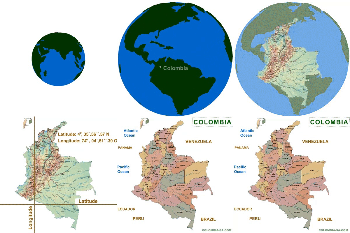
 Colombia, the gateway to South America, is located in the
center of the planet, on the equatorial line, to the extreme northwest
of the South-American cone.
 Colombia's area : 437,735 m² (1,141,748 Km² )
 Colombia shares borders with 5
countries: Brazil, Peru, Ecuador Panama and
Venezuela. Colombia shares borders with 5
countries: Brazil, Peru, Ecuador Panama and
Venezuela.
 Longitude: 74°, 04´,51.30" West
Latitude: 4°, 35´,56.57" North
 Colombia is made up of five large regions:s:
The Andean Region, where the major cities of Colombia are
found: Bogota, Medellin and Cali.
The Atlantic Coastal Region (Caribbean): with the cities
of Cartagena, Barranquilla and Santa Marta.
The Pacific Coastal Region: with Buenaventura and other
important towns.
The Orinoco Region: with the cities of Villavicencio,
Yopal and Arauca.
The Amazon Region: with Leticia and other villages.
70% of the population lives in the Andean Region.
 The Andes Cordillera (mountain range) runs in a northerly
direction through Colombia and is divided into three almost parallel
mountain chains.
These Western, Central and Eastern ranges are separated
by the two wide valleys of the Cuaca and Magdalena rivers.
 Approximately 50% of the nation's surface area is covered
with virgin forest. Approximately 50% of the nation's surface area is covered
with virgin forest.
 The Republic of Colombia is divided into territorial
entities called departments and districts, which are subdivided into
municipalities and corregimientos. The Republic of Colombia is divided into territorial
entities called departments and districts, which are subdivided into
municipalities and corregimientos.

|
 |
 |

