The Eastern Plains
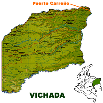
VICHADA
Inhabitant: Vichadense
The Vichadense territory is part of the
Orinoquía
Colombiana, or The Eastern Plains. It is bordered in the north by
the departments of Arauca, Casanare and Republic of Venezuela, which
also borders it in the east. It is bordered in the south by the
departments of Guainía and Guaviare and in the west by Meta and
Casanare.
It has a surface area of 100,242 square kilometres and an average
altitude of about 160 meters above sea level. It became a department in
1991.
Vichada has nearly 94,000 inhabitants. Most of its population is rural
(83.7 per cent). The great majority are native descendants from the
Guahibo and Arawak tribes and part of the territory was declared a
native reserve.
The rest of the population are settlers from
other parts of the country.
In northeast Vichada the climate is hot and quite dry. Towards the
south, the humidity increases and the vegetation is vibrant. The rainy
season extends from April to October and the dry season is between
December and February.
The department's main communications network is constituted by severeal
rivers on the Orinoco slope, such as the Meta, the Tomo and the Vichada
rivers with their tributaries and the fast-flowing Guaviare river, which
marks the border with the departments of Guainía and Guaviare.
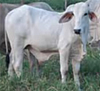
Services, cattle breeding and fishing are Vichada's main economic
activities.
Other sources of wealth are iron, titanium and quartz mining and the
extraction of fibre from the Chiquichiqui palm, used to manufacture
several handicrafts and products made of rubber.
Vichada has a great variety of wild animals. Its spectacular
biodiversity attracts thousands of tourists.
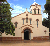
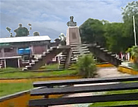
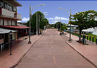
Capital: Puerto Carreño
This town was founded in 1922 and became a municipality in 1974. Its
population is approximately 10,000.
its altitude above sea level is 51 meters.
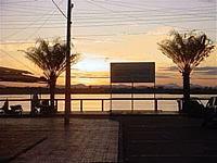
It is situated where the rivers Meta and Orinoco meet.
The average annual rainfall reaches 2,176 mm. and its average
temperature is 28 º C.
It is a little welcoming town and an important livestock and
commercial exchange centre between Colombia and Venezuela.
Its inhabitants are dedicated mainly to commerce, manufacturing crafts
and fishing.
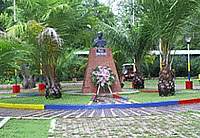
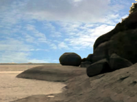
Among the main attractions are the famous torrents of Maipures, Tuparro
National Park and the islands and beaches of the Orinoco river to the
south of the capital city.