|
|
|
|
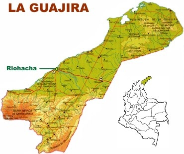
LA GUAJIRA
Inhabitant: Guajiro
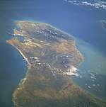
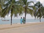
More than 540,000 people live in this peninsula partially surrounded by
beautiful white-sand beaches and the warm waters of the Caribbean Sea.
La Guajira is located in the northeast end of Colombia, with an area of
20,848 square kilometers. It is bordered, apart from its coastline on
the Caribbean Sea, by the departments of Magdalena and Cesar and by the
Republic of Venezuela.
La Guajira became an official department of Colombia on July 1, 1965.
Its economy is based on commerce, crafts and the mining, mainly coal and
salt. It also has important deposits of natural gas. The Cerrejón
coal mine, located in Barranca, which is in the north of the department,
is the world's largest open pit coal mine.
The north is home to arid and desert areas, but lower Guajira's region
is not as dry.
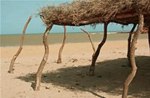
The Guajiros native tribes, also called the Wayúu, live in shacks
in the department's northen area. The Wayúu have kept their
customs, their culture and their language, which belongs to the Arawak
linguistic family. The marine salt processing in Manaure is carried out
exclusively by that community. There are 12 native protected areas in
that region.
A prominent relief in that area is the snow-covered mountain range
Sierra Nevada de Santa Marta, situated between the departments of La
Guajira, Magdalena and Cesar. The mountain range is home to another
native protected area for the Kogui tribe.
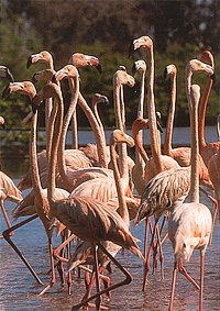
Among the many tourist destinations in the department are the animal and
plant sanctuary called �The Flamingos�, the Bahía Honda,
Cabo de La Vela, the Manaure salt mine and the national natural parks of
Macuria and Sierra Nevada de Santa Marta.
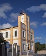
Capital: Riohacha
The first capital of La Guajira was founded in the 16 th century with
the name of Nuestra Señora Santa María de los Remedios
del Cabo de la Vela. In 1544, the capital was transferred to
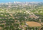
Riohacha, a city located in the center of the department. It has nearly
130,000 inhabitants from different ethnic groups who live in harmony and
peace.
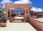
Visited by many tourists, Riohacha has very good hotels and many
nightclubs, discotheques and bars. Its outskirts also boast many places
worthy of visiting, such as the Valley of the Crabs and the Salty Lake.
At about 25 kilometers from Riohacha lies �The Flamingos�, an important
animal and plant sanctuary.
|
|
| |
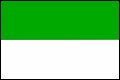
The Flag of
La Guajira
Adopted in 1966.
Modified in 1994.
|
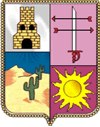
The Emblem of
La Guajira
Adopted in 1966,
Modified in1994 and
1988.
|
|
Outstanding
People Born in the region
>> Writers and Poets
>> Musicians, Composers
and Singers
>> Beauty Queens |
Music
To listen to the songs from this region,
click on the speaker below .
www.colombia-sa.com
M�sica del departamento
|
|
|
Anthem of the Deparament of
La Guajira
(In Spanish)
Lyrics:
Luis Alejandro López
Music: Carlos Espeleta Fince
Chorus
Con orgullo levanta la frente
ala suave caricia del mar
que con plácidos embelesos
te da un beso singular.
Y al recio impulso del vital progreso
que en sus brazos quiere alzarte,
ya te dispones con viril aliento
un letargo de siglos dejar.
I
Ascendiste a la vida civil
cual fulgor de raza,
en valor sin par
que a la vez que sabe padecer
también lucha por su bienestar.
Así están: Fonseca y Villanueva
con Maicao, Barrancas y San Juan
con Urbia y la gentil Riohacha,
del progreso en anhelos y afán.
II
El café, el algodón y la sal
son renglones vivos de gran valor
y a tu regio y bello pabellón
dan pureza y luciente esplendor.
Adelante ilimite Guajira,
frente franca de inmortal país
que el turismo porvenir cercano
te abrirá un horizonte feliz.
III
Urumita y Manaure en acción,
al Molino empujan en su gestión
del mundo enérgico del gas
y el carbón del vital cerrejón.
Pero se destaca la riqueza
del nativo en su hospitalidad
cuando atiende al manso forastero
que visita su tierra y su mar.
|
|
Annual Events
June: The Wayuu Culture Festival (Uribia),
Festival and contest of the divi-divi (Riohacha).
September: Accordions Cradle Festival (Villa Nueva).
Festival of Flowers and the Calaguala (Urumita).
October: National contest Coal Festival (Barrancas).
December: Festival of Composers (San Juan del Cesar).
|
|
Other Municipalities
Maicao, �the corn land�.
Urumita, called the �Garden of La Guajira�.
Barrancas, where El Cerrejón mines are.
Uribia, San Juan del Cesar,
Fonseca, Manaure, Dibulla, La Jagua del Pilar.
Airports
Almirante Padilla – Riohacha.
Maicao – Maicao.
Cerrejón Central
– Barrancas.
Protected Region of Colombia
Tayrona National Natural Park
(La Guajira � Magdalena).
Flora and Fauna Sanctuary
Los Flamencos
Area: 7,000 hectares.
National Natural Parks
Macuira
Area: 25,000 hectares.
Sierra Nevada de Santa Marta
Location: Region of Magdalena, Guajira and Cesar.
Area: 383,000 hectares.
|
| |
|
|