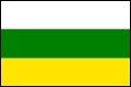
 HUILA
HUILA
Inhabitant: Huilense
In 1538, Sebastián de Belelcázar, the first Spaniard to
arrive on this land, named the region
Valle de Neiva, which was
integrated into the Federal of State Tolima in 1857. In 1905 the State
was divided and the department of Huila was fouded in 1910.
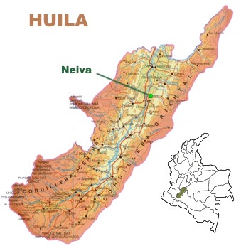
This great south-western Colombian territory, has an area of 19,890
square kilometers with a population of 982.900 inhabitants.
Huila is bordered by Tolima, Cundinamarca, Meta, Caquetá and
Cauca. It is located between the Eastern and Central cordilleras
(mountain ranges), and crossed by the valley of the Magdalena River,
between the two
cordilleras.
Its main geographic features are the
Nevado del Huila, the
Pan de Azucar snow-covered hill,
Las Papas moor and
the Colombian massif where the Magdalena River rises.
The Betania Reservoir, built where the Magdalena and Yaguará
rivers meet, is of great importance to the country.
The department has a very good farming activity, producing a wide
variety of crops such as rice, yucca, corn, sorghum, beans, cotton,
potatoes, sesame, tobacco, sugar cane, banana, coffee and cocoa.
In the subsoil area it has deposits of petroleum, natural gas, gold,
silver, quartz and
calcita .
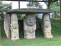
Before the arrival of the Spaniards, the region was populated by warrior
native groups of the Caribbean family: the Paeces, Yalcones and Pijaos.
Some descendants of those tribes still exist and they are located in
three protected zones and in other small communities.
At present, the
opitas (people from Huila), as they are
friendly called, are mostly descendants from Spaniards and mestizos
(racially mixed).
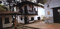
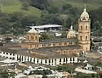
Huila offers beautiful landscapes and archaeological treasures like the
desert of the Tatacoa, the Cave of the Guácharos, the San
Augustin archaeological centre, San José de Isnos and the
Magdalena Lake.
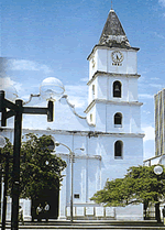
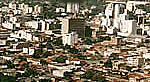
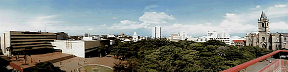
Capital: Neiva
Neiva, the capital of the Department of Huila, with a dry climate and an
average temperature of 27 degrees Celsius is situated on the banks of
the Magdalena river; It is a lovely small city, well planned and very
progressive. It has a population of about 340,000 people.
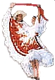
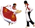
The city is known for its traditional celebration of the
San Juan
and
San Pedro festivals and the National
Bambuco
Competition, which take place between June 24 and July 3. These
festivals are full of happiness. The beautiful and graceful girls light
up the streets by wearing their dashing typical
huilenses
dresses decorated with sequins, flowers and embroidery. Under the
awnings, located in many places of the city, people gather to sing and
dance the
sanjuanero, the authentic "rhythm of Huila folk
music",
rajaleña and
bambuco. In the
private social clubs there are big parties with the best orchestras of
Colombia. The festival ends with a parade of floats decorated with
flowers and pretty girls and with the crowning of the
Bambuco
Queen.
Péguese the rodadita� (hit the road) is the popular
expression used by the
neivanos to invite all people to their
festivals. And it is really worthwhile to "hit the road" to
Neiva.