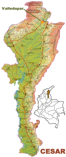
CESAR
Inhabitant: Cesarense
With an area of 22, 925 square kilometres and 1.1 million people, this
wealthy and fertile soil region is located in the North Eastern part of
Colombia. It borders La Guajira, Magdalena, Santander, Norte de
Santander and Bolívar Departments, and the Republic of
Venezuela.
Until 1967 it was part of the Department of Magdalena, which borders the
Caribbean Sea. Colombians still consider the Cesarense �coastal people�
even Cesar no longer has a coastline.
Before the arrival of the Spaniards, the land was inhabited mainly by
the native tribes
Euparíes in the Valley of Upar, the
Guatapuríes in the Cesar river valley and the
Orejones,
Motilones and other tribes
in
different places of that territory. They lived by farming, fishing and
hunting. Today, some of them have their own way of living and their own
autonomous government.
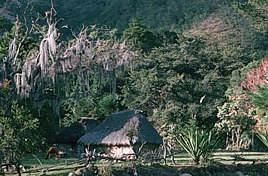
The climate varies greatly in Cesar, which spans four geographical
regions: the mountain ranges of Perijá and Motilones (a section
of the Eastern
Cordillera), the adjoining Magdalena river zone,
the central plains and the
Sierra Nevada de Santa Marta .
Cesar's economy is based on agriculture (food crops and livestock),
mining and industry. Cesar is Colombia's biggest cotton producer and the
country's third most important producer of rice. Bananas, sugar cane,
African palm, sorghum, yucca are other significant crops. Dairy cows are
Cesar's most important livestock, raised in the plains region. Coal
excavation makes up most of the mining industry.
Capital: Valledupar
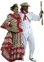
Cesar's capital city, Valledupar , is known as both the �World Capital
of the Vallenato � (a folk-music rhythm from the coastal region) and the
�City of the Holy Kings of the Valley of Upar �. It was founded at the
foothill of Sierra Nevada de Santa Marta by Hernando Santana in 1550 and
now has about 250,000 inhabitants.
It is one of the most important farming regions in the country.
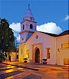
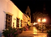
There are many governmental, cultural, religious, educational, sporting
and historic sites to visit such as the Municipal Council, the House of
Fine Arts, the House of Culture, the Popular University of Cesar, the
Loperena National School, the cathedral of Our Lady of Rosary, the
church of La Concepción, the Julio Monsalvo Castilla coliseum,
the Alfonso Lopez Square, among others.
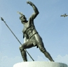
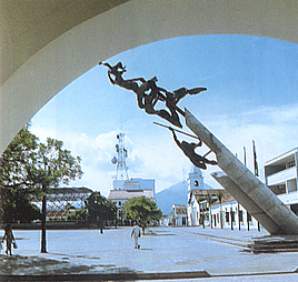
The city boasts many interesting landmarks, such as the monuments to the
Overlord Upar, the Chichamaya, a "Piece of an accordion",
"The Course of the Revolution", the Obelisk, the Siren of
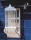
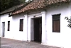
Hurtado and the Poporos. Lovely colonial-style houses contribute to the
area's charm. The Guatapurí river is one of the symbols of
Valledupar .
Each year, the city celebrates �the Festival of the vallenato legend�
during the last week in April. It is one of the most popular and
well-known folk music events in Colombia .